Home page  |  Flights to Crete  |  Car rental in Crete  |  Holiday apartments  |  Info Crete  |  Road maps  |  Distances in Crete  |  Contact us

Versione in Italiano   Greek version   German version   Version fran?ise

<<<<<<<<<< >>>>>>>>>>

Version fran?ise   German version   Greek version   Versione in Italiano

Geographic info (the beaches of Xerocampos)

Environmental information

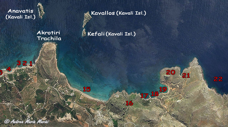
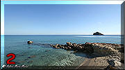
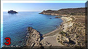
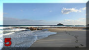
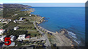
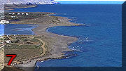
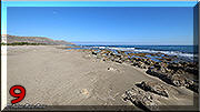
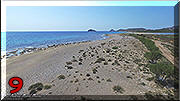
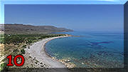
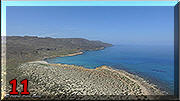
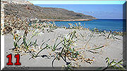
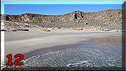
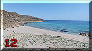
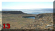
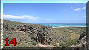
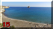
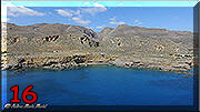
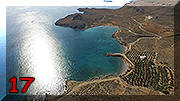
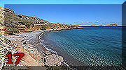
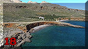
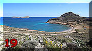
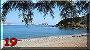
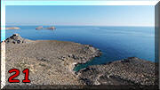
About Xerocampos, located in the eastern part of Crete, more than a single inhabited area, we can speak of a strip of coastline, up to 900 meters wide and sparsely populated, facing south and overlooking the Libyan Sea, which for about 6 km presents an alternation of wide sandy or pebbly beaches, sheltered coves and even long stretches of cliffs.


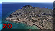
Nearly in the center of this area and always oriented to the south towards three uninhabited rocky islets, the Kavali Islands (Anavatis, Kavallos and Kefali), there is a hilly promontory called Akrotiri Trachila (54 meters above sea level) which divides the coast into two sections.

Practical

info

Info

distances

Tourist

info

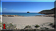
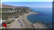
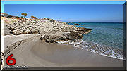
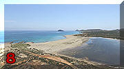
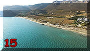
In the north-east part of

Xerocampos,

starting from the base on the left of the promontory of Akrotiri Trachila, we meet :

Info

Meteo

How

to reach

  1. Agios Nikolaos, bay with beautiful sandy beach (size 70 meters x 35 meters approximately), comfortable and easy access to the sea, shallow water for a long stretch, has no shady areas; it can be reached by car along 680 m. of dirt road - beach also frequented by naturists

Agios Nikolaos
  1. Argilo, a recent name given to a stretch of coast characterized by a cliff of white clay (very appreciated to make skin purifying masks ..... a real "spa" in the open air) at the base of the plateau that houses the small church of Agios Nikolaos (the patron saint of sailors), edged by a thin strip of sand (size 100 meters x 8 meters approximately), comfortable and easy access to the sea, has no shady areas (but it is the first beach to enter in the shade at sunset); It can be reached by car along 700 meters of dirt road - beach also frequented by naturists

Argilo
Argilo
  1. Gerontņlakos, small sandy beach (size 50 meters x 10 meters approximately), comfortable and easy access to the sea for almost its entire length, has only one tamarisk to give a little shade; it can be reached with 80 mt. of walking path (it is advisable to park in the public car park at the beginning of the path) - a beach frequented by naturists too

Gerontņlakos
  1. Ambelos, bay with mainly sandy beach (size 150 meters x 20 meters approximately), comfortable and easy access to the sea for almost 2/3 of its length, has a dozen umbrellas for rent (5 euros each with two deckchairs, price 2019) and some tamarisks to give shade; it is located along a paved road and has ample parking and one public chemical toilet - beach for families

Ambelos
Ambelos
  1. Vourlią, awarded with the blue flag for several years is a bay with sandy beach (size 100 meters x 15 meters approximately), comfortable and easy access to the sea, has twenty umbrellas for rent (5 euros for one with two deckchairs) and some tamarisks to give shade; It is located next to the paved road and is the closest to two taverns offering public showers, it is also equipped with a beach dressing room - beach for families

Vourlią
Vourlią
  1. Karavopetra, alternating stretch of sandy coves and rocks (linear dimension about 250 meters with width from 2 meters to 15 meters but it is a figure of the early months of 2018 subject to possible variations because it is a beach exposed to natural erosion and nourishment), comfortable and easy access to the sea for almost all its length, has no shady areas; it is located next to paved road - family beach

Karavopetra
Karavopetra
  1. Limanaki, a small sandy beach (size 35 meters x 20 meters approximately), comfortable and easy access to the sea for half its length, has no shadow; it can be reached by car along 230 meters of dirt road - beach also frequented by naturists

Limanaki
  1. Alatsolimni, wide sandy area (200 meters at the widest point), dry in summer, in winter turns into a brackish lagoon, presents on the coast a beautiful and large beach (about 330 meters long) mainly sandy although with many rocks, comfortable and easy access to the sea for almost 1/2 of its length, has no shady areas (it is the last beach to go in the shade at sunset); It can be reached by car along 340 meters of dirt road and has a large car park, beach dressing room and public shower - beach for families but also frequented by naturists (in its most eastern part)

Alatsolimni
Alatsolimni
Alatsolimni
  1. Patelia, long stretch of coast with mainly sandy beach (linear dimension about 430 meters with width from 9 meters to 30 meters), access to the sea is difficult for almost all its length due to the presence of low rocks and gravel areas (its waters are quite interesting for snorkeling), some tamarisks give shade; It can be reached by car along 800 meters of dirt road - beach also frequented by naturists

Patelia
Patelia
  1. Potamņs, pebble beach (size 280 meters x 15 meters approximately) located at the mouth of a stream dry for most of the year, access to the sea uncomfortable for its entire length, has only a pair of tamarisks to give shade; it can be reached by car along 770 meters of dirt road - beach also frequented by naturists

Potamņs
  1. Katsounaki, a particular and singular wide area (4,7 ha.) consisting of sand dunes shaped by the winds, partially covered with low natural Mediterranean coastal vegetation, bordered by both flat and jagged cliffs for its entire length, difficult the access to the sea; it can be reached by car along 1.140 m. of dirt road to a small parking lot and then on foot with an easy path of 125 meters

Katsounaki
Katsounaki
  1. Alņna (recently renamed Krinakia), beautiful sandy beach (linear dimension about 80 meters with width from 15 meters to 35 meters), comfortable and easy access to the sea for its entire length, shallow water for a long stretch, has no shady areas; it can be reached by car along 1.140 m. of dirt road to a small parking lot and then on foot with an easy path of 210 meters. (which continues to Kato Zakros) - a beach frequented by naturists

Alona
Alņna
  1. Roussospasma, small sea inlet to the north-east of Xerocampos (interesting its seabed to practice snorkeling) with small pebble beach (linear dimension about 25 meters with width from 4 meters to 10 meters), access to the sea uncomfortable for its entire length , has no shade, can be reached by car along 1.140 mt. of dirt road up to a small parking lot and then on foot with a path of 1.060 meters passing next to Alņna, last short stretch in the middle of the rocks - isolated beach, attention to the possible rockfall

Roussospasma
Roussospasma
  1. Gorge to Zakros, entrance to the path that crosses the gorges leading to Zakros (challenging and unmarked route)

Gorge to Zakros

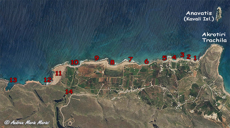
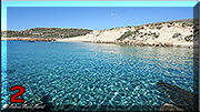
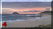
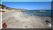
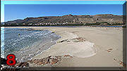
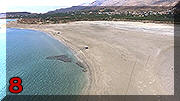
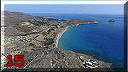
In the part of Xerocampos facing south-west, therefore looking to the right of Akrotiri Trachila, you will find :

  1. Mazidą i Ammos also called "Megaliparalia" ("Long beach"), bay with beautiful sandy beach (linear dimension about 760 meters with width from 4 meters to 30 meters), comfortable and easy access to the sea for almost all the its length (only about 1/10 is low cliffs and creates some problems of access), shallow water for a long stretch, has no shady areas but you will find 24 umbrellas for hire (10 euros each with two deck chairs, price 2019); it is located next to paved road so it is easy to park, it has a public chemical toilet - beach for families but also frequented by naturists (in its most western part)

Mazidą i Ammos
Mazidą i Ammos
Mazidą i Ammos
  1. Gorges to Ziros in the Ligiąs area, entrance to the path that crosses the gorges leading to Chametoulo, Lamnoni and Ziros (path L3 in the page dedicated to the "Paths of Crete")

Ligiąs (gole per Ziros)
  1. Ligiąs Lakos, small bay with pebble beach (linear dimension about 90 meters with width from 4 meters to 13 meters), acess to the sea uncomfortable for its entire length, has a pair of tamarisks to give a little shade; it can be reached by car along 870 meters of dirt road to a small parking lot and then for a short and steep stretch (35 meters) on foot, beach which is the most protected in Xerocampos from the summer winds of Meltemi - frequented also by naturists

Ligiąs Lakos
Lygiąs Lakos
  1. Mikri Ligią next to Ligią Lakos, a small bay with pebble beach, (linear dimension about 59 meters with width from 2 meters to 9 meters), access to the sea uncomfortable for its entire length, has no shadow; reachable only by sea

Mikrģ Ligiąs
  1. Amato or Amatou, bay with a thin pebble beach (linear dimension about 70 meters with width from 3 meters to 10 meters), is an inlet that is used as a small port because it is protected and equipped with a concrete platform for entry to the sea, very interesting its seabed to practice snorkeling, access to the sea uncomfortable for its entire length, has only one tamarisk to give shade; it can be reached by car along 1.400 meters of dirt road

Baia di Amatou
Spiaggia di Amato
  1. Paranoma, hill (39 meters a.s.l.) with a characteristic shape that overhangs and protects the Amatou Bay

Paranoma
  1. Avlaki, a small rocky inlet with very interesting seabed for snorkeling, can be reached by car along 1.770 meters of dirt road and then for a short path (110 meters) on foot

Avlaki
  1. Overlooking the Bay of Agia Irini, the rocky stretch of coast that ends Xerocampos to the west.

Bay of Agia Irini

Versione in Italiano   Greek version   German version   Version fran?ise

<<<<<<<<<< >>>>>>>>>>

Version fran?ise   German version   Greek version   Versione in Italiano

Car rental in Crete  |  Holiday apartments in Xerocampos  |  Photographic album of Xerocampos  |  Information

©Andrea Maria Marini andrea18@otenet.gr - marinator2001@yahoo.com


Registered in the Register of the Touristic Companies of The Tourist Greek Organisation (EOT) since 25.09.2013 with authorization number 1040E 6061 01822 01

Licenza Creative Commons
All the texts, the layout and the photographic elaborations of this page are property of Andrea Maria Marini - www.xerocamboscreta.com - the images and the satellite metric and altimetric surveys are courtesy of SunEarthTools.com